Geographic and Database Consulting Services
Conservation ~ Environment ~ Ecology
Low cost solutions for non-profit, academic and small government organizations
Geographic Information Systems
Data acquisition, GIS analysis and reporting
Clients include:
Terradex
Adirondack Atlas
Adirondack Land Trust
Beier Lab at SUNY-ESF
Adirondack Council
Cary Institute of Ecosystem Studies
Protect the Adirondacks!
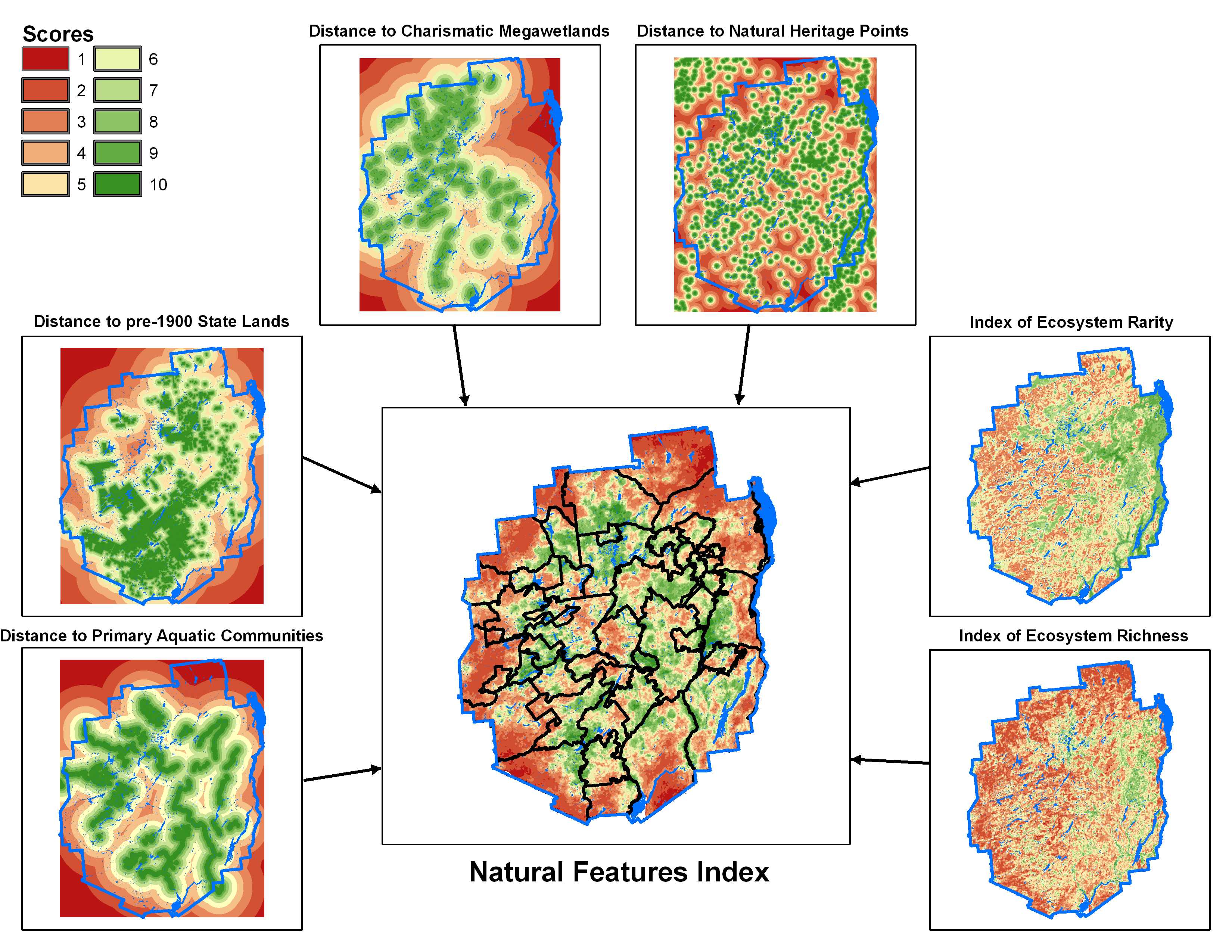
Cartography
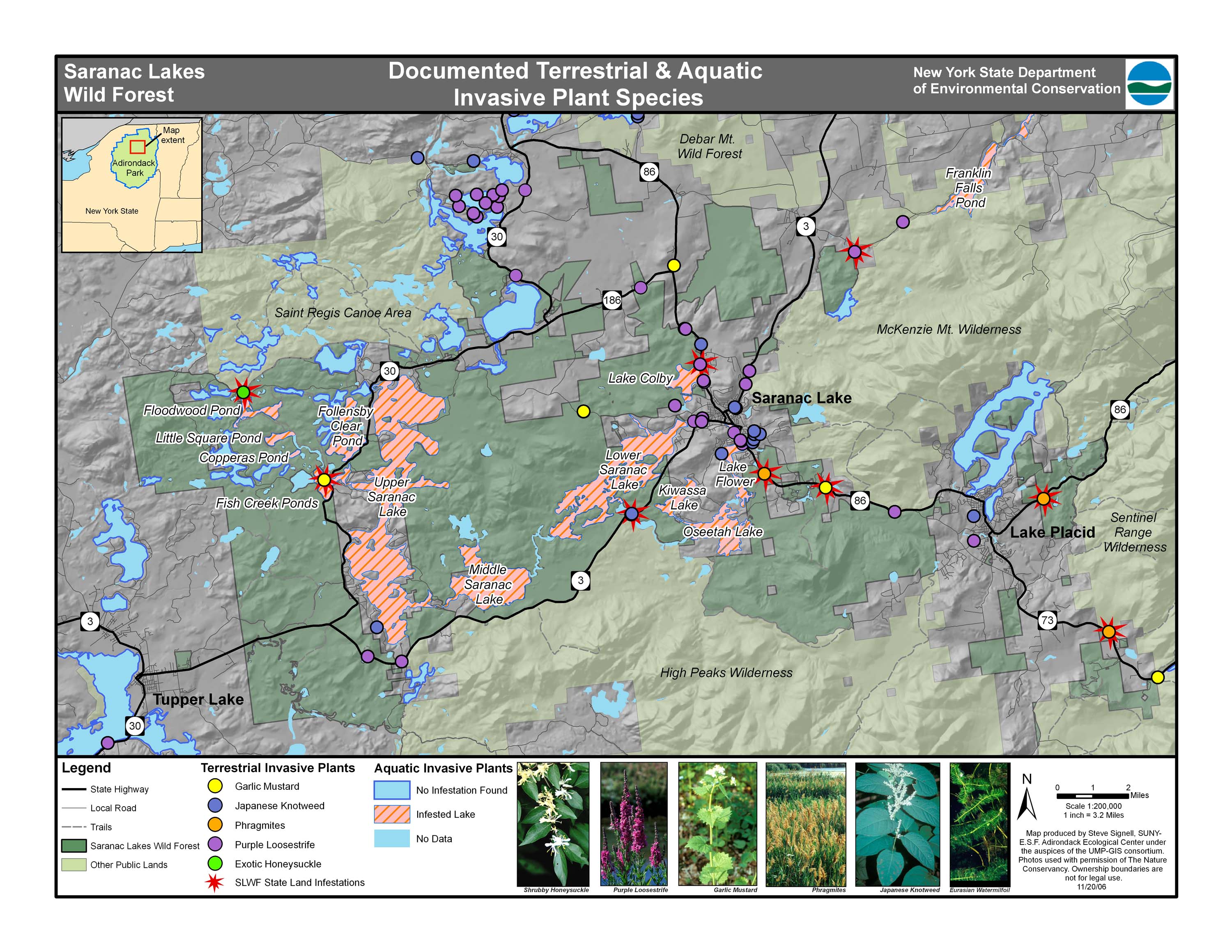
Award-winning paper maps, interactive web maps, and off-line mobile-friendly trail maps.
Examples include:
Adirondack Atlas Project
NY Climate Change Clearinghouse Map
Hyuck Preserve Trail Guide
Ponca Tribe Assets Map
Topsham, Maine Tax Parcel Viewer
Adirondack Interpretive Center Trail Map
Database Management
Relational and spatial database solutions, with a focus on GIS and environmental concerns.
Clients include:
Adirondack Long-Term Monitoring Program
Adirondack Atlas
SUNY-ESF
UVA Mountain Lake Biological Station
USC Wrigley Marine Science Center
Cary Institute of Ecosystem Studies
Town of Topsham, Maine
Forest Ecology
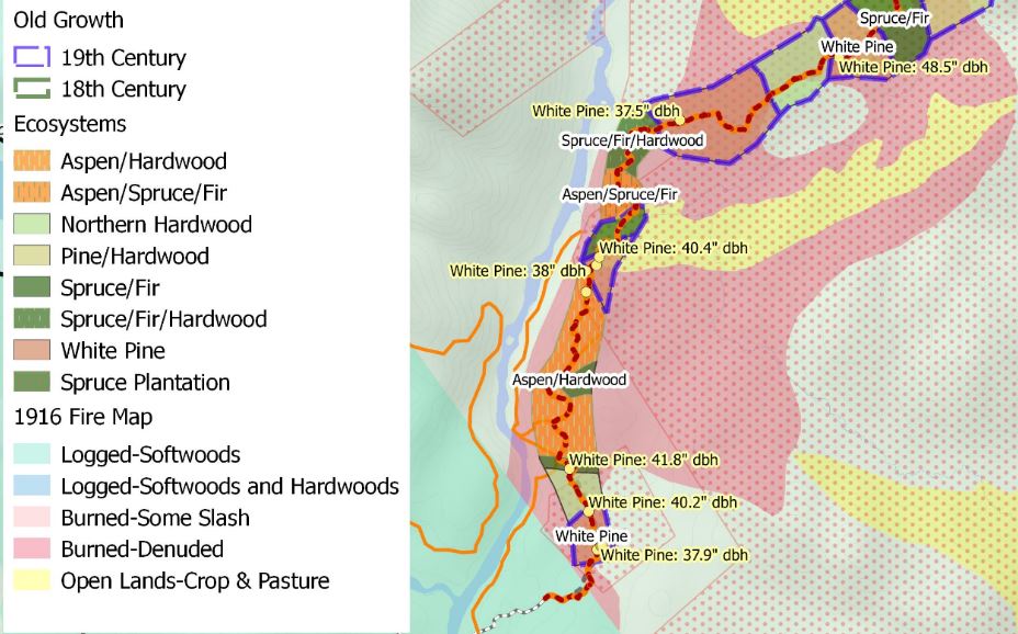
Ecosystem mapping, forest inventories and tree-ring analysis
Contact
Frontier Spatial, LLC
1035 Williams Road, Colchester, VT 05446
Phone: (518) 232-1008
email: steve@frontierspatial.com